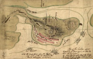
As mentioned in class, while Bunker Hill is tallied a British “win” (they captured the ground), the victory came at a calamitous price. 1,054 of the Crown’s officers and soldiers fell casualty in the course of fighting – the highest casualty count suffered by the British in any single encounter during the entire war.
“The True Story of the Battle for Bunker’s Hill,” provides a great deal of detail not only about the day’s fighting, but also about daily life and the environs in and around colonial Boston.
It probably wasn’t anything like you think. For one thing,
Boston in 1775 was much smaller, hillier and more watery than it appears today. The Back Bay was still a bay and the South End was likewise underwater; hills were later leveled to fill in almost 1,000 acres. Boston was virtually an island, reachable by land only via a narrow neck. And though founded by Puritans, the city wasn’t puritanical. One rise near Beacon Hill, known for its prostitutes, was marked on maps as “Mount Whoredom.”
Check out the rest of the story HERE

 Saving...