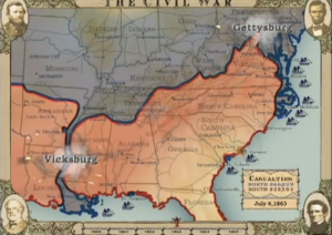
 Those interested in “seeing” the Civil War from a perspective more dynamic than the one available in textbooks and monographs should check out this Google-powered interactive map of the Battles and Casualties of the Civil War commissioned in 2011 by the Washington Post. The Flash-based animated sequence does an excellent job of portraying the scale and scope of casualties associated with the America’s most divisive and bloody conflict. [Note, keep an eye on lower-right portion of the map to catch Sherman’s “March to the Sea” and subsequent campaign in the Carolinas.]
Still more impressive is an earlier (2007) production commissioned by the Abraham Lincoln Presidential Library and Museum in Springfield, IL. “The Civil War in Four Minutes” is a riveting, animated feature portraying the outbreak and progress of the war via shifting battle lines, flare-ups marking major battles, and a rising body count. Visitors to the Lincoln Library and Museum see the events unfold on a giant screen. Those unable to make the (highly recommended) trip can watch the video HERE.

 Saving...